What deliverables can you provide?
We dont just provide you with pretty pictures. We will process data into usable outputs to match your workflow. CAD roof plan? Digital Terrain Model? Full CAD topo? No probem. Icing on the cake? Online interactive 3D models for you to share and collaborate. Imagine every member of your team working with uptodate data and no sharing of documents by email?
Do you charge for a quote?
No we do not. Our service starts with a free no-obligation quote – there is no pressure from us to proceed if you do not want to.
Do you need a licence to fly a drone?
Depending on the size of the drone and where you want to fly it. All our pilots and operators are CAA approved, for your peace of mind, holding Operation Authorisation, GVC and A2CofC permissions.
Why do I need a drone to check the roof, I can use a ladder?
You're perspective and the detail you can see will be limited, even from a cherry picker. Using drones we can get full coverage of your roof, in high resolution, even areas that are usually difficult to access. Images and video are presented in a secure cloud based portal to make identification and reporting of defects much easier.
Using specialist drones with infrared and zoom cameras, we can pick up on even small defects.
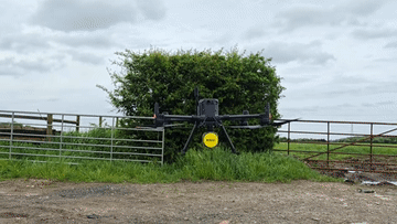
The term drone is widely used to describe unmanned aerial vehicles (UAVs). Basically a “drone” is a flying robot that can fly autonomously with software-controlled flight plans or from a remote control device.
Other names for drones often include UAS, SUAS, UAV, Multirotor, Quadcopter.
In the UK under standard permissions from the CAA, you should not fly higher than 120M (400ft) from ground level.
In theory, they can keep on going up either until the battery runs out or the air becomes too thin to support flight or the signal from the controller is lost.
Most of our data tends to be best captured between 100ft and 200ft as this gives the best balance between resolution and coverage.
How long can you stay in the air for?
Depending on the drone and the weather conditions, drones can remain airborne from 15 minutes to just under an hour.
This is dependent on the temperature, wind speed, payload weight and aircraft type.
Most tasks can be achieved easily in this time – if not, it takes seconds to land, change the battery and be airborne again.
What weather can you operate in?
All of our drones can fly in winds of up to 20 mph, although this is not advised.
Some of our drones can fly in light drizzle or mist, but this limits the quality of the data that can be captured.
Flying when it’s cold reduces the flight time and results in frozen fingers!
However, we will always take weather conditions into account and ensure our flights are performed safely.
What does the law say about drones?
In the UK, drones must be operated in accordance with the law, whether they are being used for recreation or commercial purposes.
If operating commercially with a drone weighing more than 500g, an Operation Authorisation (previously known as PfCO) must be obtained from the Civil Aviation Authority (CAA).
For more information google the 'Drone Code' from the CAA.
We cover most of the north of England, from Scotland and Cumbria down to the West Midlands.
Just ask, if you are further afield, we have a network of approved pilots to cover most areas.
What data can you capture?
We have access to a range of sensors.
Our work is conducted in high definition stills and video, 4k super high-resolution video and infrared thermal imaging. This supports a wide range of applications.
Using these sensors together with professional software and expertise, we can create maps, CAD drawings, 3D models etc
We work with you to understand your requirement and aim to deliver right first time, every time.
Do you provide a report for inspections?
Data is provided via an interactive, secure, online portal where you or your engineers can review the inspection, pinpoint and annotate areas of interest and generate a report if required.
The platform or report can be shared as you require.
If a formal specialist report is required we can arrange this for you using trusted qualified building surveyors.
Do I need to be on site for you to complete an inspection or site survey?
Provided we have access to the site and landowners permission, you do not need to be on site.
We will complete the survey and provide the data for you to review remotely.
We can even provide a real time feed from the drone if required.
Will you work with our engineer?
Of course. If there is a specific issue or a specialist area you want to address, we can work with an engineer on-site or remotely via live stream.
In either case, your engineer can view the live feed from the drone and direct the pilot if required.
Using internet technology, we can broadcast the image straight from the drone to your PC or tablet.
You can communicate with our pilot and review the images of your building in realtime.
What is your CHAS accreditation?
We are CHAS Premium Plus accredited contractors. This is a Safety Schemes in Procurement (SSIP) accreditation which demonstrates our commitment and compliance in several key areas of health and safety.
All inspections performed by DroneWorks are planned and executed with safety as the priority, protecting your reputation.
All commercial work requires insurance. As standard we carry one million pounds of public liability cover. This can be increased to cover a specific project as required.