New Blog Post:
How much does a lidar survey cost? What's the buzz about LiDAR? Read about it 👉

Skelmersdale Drone LiDAR Surveys

LiDAR is transforming large area planning processes. Accurate levels and topographic data of vegetated areas. Upto 100ha per day.

Contact Us

LiDAR Topo Surveys for Planning & Design

Accurate surveying of vegetated areas, ground level beneath trees, power lines, forestry management and more. Centimeter accurate topographic surveys.

Data in Vegetated Areas

Accurate terrain models in vegetated areas. Classified point clouds and accurate DTM from ground.
Mockup

Multiple Applications

Foresty management, powerlines, clash detection and full topo surveys
Mockup

Advanced LiDAR Equipment

High end lidar scanners to ensure accurate, noise free data.
BLOG Articles

How Much Does A LiDAR Survey Cost?

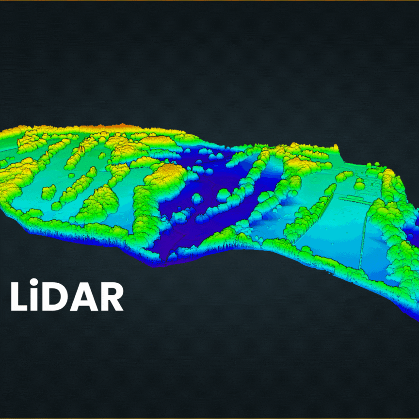
It’s one of the most common questions we get at DroneWorks. Here’s a clear, no-nonsense breakdown of what influences pricing, why it varies, and how to get the best value for your project..

Use Cases For LiDAR

LiDAR for Infrastructure Planning & Design

LiDAR enables the creation of accurate Digital Terrain Models (DTMs) and Digital Elevation Models (DEMs), which are essential for planning roads, bridges, and other infrastructure.
Accurate terrain models in vegetated areas
Large and difficult areas covered quickly & safely
Visualise and interact with your site in 3D

LiDAR for Forestry Management

LiDAR's ability to penetrate the forest canopy allows for accurate measurement of tree height, canopy cover, and terrain mapping, leading to better-informed management decisions and sustainable practices.
Tree height & volume
Tree counts & Canopy Cover
Biomass estimation

LiDAR for Large Area Topo Surveys

LiDAR performs well in areas with dense vegetation, steep slopes, and other challenging conditions where traditional surveying methods may struggle
Upto 100ha in a single day
Speed & Efficiency over larger areas vs traditional methods
3D Data & CAD deliverables

Accuracy & Precision over Large Areas

Accurate data over large areas, quickly and safely
100ha / 250 acre ins a single day
5cm accuracy verified by surveyed points on the ground
Fast Turn Around: Deliverables in 7 days

LiDAR Data for Flood Risk Assessment

LiDAR data generates precise digital elevation models (DEMs) that represent the terrain's topography, which is essential for accurate flood modeling.
identify areas at risk of flooding
Overland Flow Analysis
Detecting Changes in Terrain

LiDAR in Numbers

1.2m

1.2 million laser pulses per second, low noise, accurate lidar

300ppm

Averagepoint density in open ground

100ha

100 ha / 250 acres surveyed in a single day

Credentials - Always Use A Qualified, Insured Operator
CAA Approved Drone Operator
£5m Public Liability
£2m Professional Indemnity
Constructionline Gold SSIP Accredited
CSCS Card Holders
Jason Hinsley
DroneWorks
Dronedesk verified badge

LiDAR Surveys in Skelmersdale and across North West

Need a Quote for Your Project?

Contact us or book a meeting to talk it through and discuss the options
Get Started

Frequently asked questions

Common questions for LiDAR Surveys

Have a different question?
Contact Us
Is LiDAR More Accurate Than Photogrammetry?

This is a common misunderstanding. They are two differeing methods of collecting data, one use lasers one uses high resolution images, they both have their benefits in differeing situations.
Photogrammetry is actually more accurate, but does not deal with vegetation well.
We will advise on the best approach for your site & requirements.
We also include photogrammetry with our lidar surveys!

What LiDAR Scanner Do You Use?

The DJI L2 is a popular choice due to its cheaper price point but it is an enry level LiDAR unit.

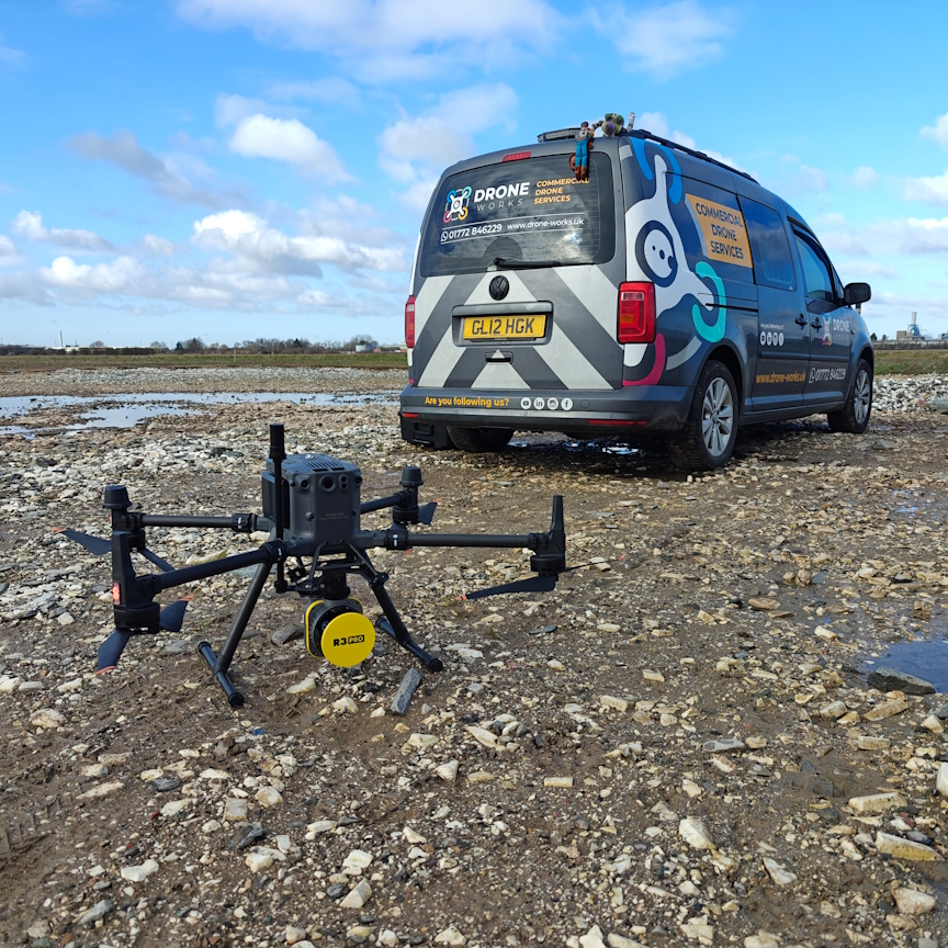
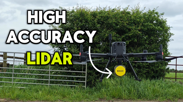
We use a more advanced scanner, Rock Robotic R3 Pro, that produces clean, noise free and accurate data.
We also use advanced software to enable strip alignment, georeferencing and GC checks.

Can LiDAR See Through Trees & Vegetation?

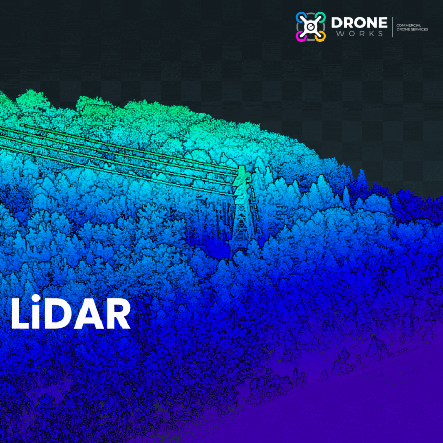
LiDAR uses lasers which find their way through tiny gaps in vegetation, rather than seeing through it. Some of those lasers will find their way to the ground, enabling measurements beneath trees and vegetation.

How Accurate Is LiDAR?

This depends on the equipment, height and speed of the flight plan and density of vegetation.
However, LiDAR surveys are usually accurate to 5cm in x,y and z.
We verify this using surveyed points on the ground.

What Deliverables Can You Provide?

This is the important part, the deliverables are derived from the lidar point cloud. Terrain models, TIN Surface and full CAD topo's are all possible.
We will extract data into deliverables that you require, in a format that you can work work.

Where can I see some of your work?

Sure, contact us for an example. Besure to let us know the use case. Eg Foresty, Planning, Land topo etc